


Real World Terrain – Unity
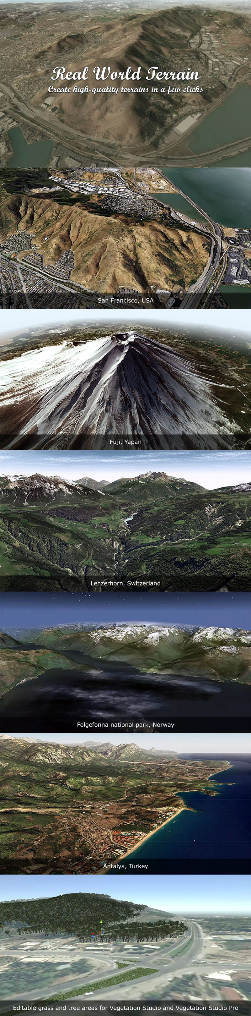
Real World Terrain – Unity
Turn any location on Earth into Unity-ready terrain, meshes, Gaia stamps, or RAW files using real elevation data, satellite imagery, and OpenStreetMap content.
Real World Terrain is built for developers who need a fast, practical way to recreate real places inside Unity for games, simulations, visualization, and large-world prototyping.
Generate terrain, textures, roads, buildings, rivers, trees, and grass from real geographic data, then bring the result directly into your scene or export it for your own workflow.
Why Real World Terrain
With a few clicks, you can generate:
Unity Terrain, meshes, Gaia stamps, RAW, or Mapbox RGB height exports
Satellite or map textures, plus Terrain Layers from Mapbox vector tiles
Roads, buildings, rivers, trees, and grass
This makes Real World Terrain much more than a heightmap tool.
It is a complete real-world terrain generation pipeline for Unity.
Best for
racing and driving games
flight, drone, and military simulations
strategy and open-world prototypes
education and geographic visualization
environment blockouts based on real locations
technical art and terrain production pipelines
Main Features
Generate real terrain in a few clicks
Select an area by coordinates, choose the output type, and generate terrains based on real elevation data from virtually anywhere on Earth.
Multiple output formats
Create Unity Terrain, mesh terrain, Gaia stamps, RAW files, or Mapbox RGB heightmaps depending on what your workflow needs.
Elevation sources
Use Mapbox elevation data with up to 5 meters resolution, SRTM v4.1 with up to 90 meter resolution, or SRTM30 with up to 30 meter resolution.
Imagery sources
ArcGIS, DigitalGlobe, Map Quest, Mapbox, Mapy.CZ, Nokia Maps (here.com), Virtual Earth (Bing Maps), Open Street Map, Sentinel-2, plus custom tile URLs. Built-in imagery sources provide up to 0.15 meters per pixel resolution.
Generate world structure
Generate buildings, roads, rivers, trees, grass, and Terrain Layers from OpenStreetMap, Mapbox, and Geoapify data.
Editor and API support
Work through the editor UI for quick setup or automate generation through the API for repeatable pipeline tasks.
Scene-ready base content
Use the generated result as a starting point for your own shaders, materials, assets, and gameplay systems.
block out worlds faster
recreate real environments for gameplay
generate terrain reference for artists and level designers
export data into existing terrain workflows
enrich scenes with roads and structures from map data