


Real World Terrain
Real World Terrain
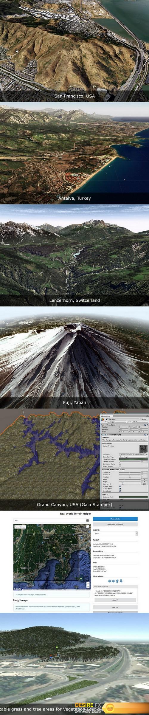
Real World Terrain is a tool for creating terrains, meshes, Gaia stamps and RAW files, based on real geographic data and objects based on Open Street Map.
Features:
• Unity v5.6 – Unity 2019.x.
• Elevation Heightmaps:
– ArcGIS resolution of max 10 meter per pixel;
– Bing Maps resolution of max 10 meter per pixel;
– Mapbox;
– SRTM v4.1 resolution of 90 meters per pixel;
– SRTM30 resolution of 30 meters per pixel.
• Texture providers: ArcGIS, DigitalGlobe, Map Quest, Mapbox, Mapy.CZ, Nokia Maps (here.com), Virtual Earth (Bing Maps), Open Street Map + ability to download tiles from custom url.
• Satellite images resolution of max 0.25 meter per pixel.
• Can create: Unity Terrains, Meshes, Gaia stamps, RAW files.
• Can create objects based on Open Street Map:
– Editable roads for EasyRoads 3D v3 and Road Architect;
– Editable buildings for BuildR2 (editable) or built-in building engine;
– Rivers;
– Trees;
– Grass.
• A tool to select area directly on Google Maps.
• A lot of extra tools for working with coordinates, objects and postprocessing.
• Unlimited number of generated terrains.